Friday, November 27, 2015

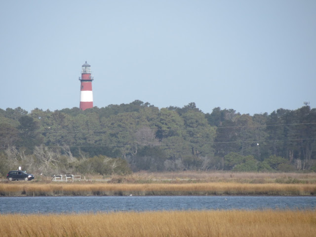
Rodanthe


So we've been hanging out in Rodanthe, North Carolina for the past few days.  It's a pretty nice little town, kinda sandwiched between two parts of Cape Hatteras National Seashore.  There are actually three towns here, Rodanthe, Waves, and Salvo, but it's hard to tell, except for the signs on the shops.

The other day, we drove down to Hatteras (the town) for the day.  We drove around the state park a bit, and through this flooded campground, which was pretty fun.  We also saw a windsurfer on the beach.
The beach at the state park

Driving through the flooded campground at the state park

Someone windsurfing on the beach -- it was really windy!
After the state park, we went over to the Graveyard of the Atlantic museum (shipwrecks!) which was cool.  I thought the stuff about the USS Monitor was cool (one of the first ironclads, fought for the Union in the Civil War, fought the USS Virginia (Confederate ironclad) until both of them gave up.)  They had some bits and pieces and pictures of a sunken German U-boat, including the Enigma machine. (Cryptography thingy)
The Engima Machine from U-85
After the museum, we went over to take the ferry to Ocracoke Island, which is 2 miles or so from Hatteras.  We waited around for an hour or two, then took a pretty long ferry ride.  The ferry stayed in the sound, so it wasn't too rough, but the boat tipped a fair amount when it turned.  We drove around Ocracoke a bit, then started heading back.  We just barely couldn't fit on the first ferry, so we ended up waiting another hour or so.  By then, it was totally dark, so we spent another hour on the ferry in the darkness when it finally arrived.  By the end of all this, it was 8 or 9, and we were all exhausted, so we went back to the RV and crashed.
The ferry ride over to the island
A beach on Ocracoke Island
I've taken a few bike rides around Rodanthe (and Waves, and Salvo) and it's pretty different from any other place we've been.  The island we're on is pretty narrow, so the towns are basically one road running through the middle, with a bunch of smaller roads going off to either side.  Probably 90% or so of houses around here have "For Rent" signs on them, and most of them are raised up on stilts, at least to some degree.  It seems like quite a few families rented a house for Thanksgiving, because there are a few empty-looking houses, and then one house with 5 or 6 cars in the driveway.  The houses are pretty big, you could certainly fit an extended family in one, but I don't think it would come cheap, especially because most of the houses have some kind of waterfront, or at least access to the water.

My dad and I set CHDK up on both of the cameras, and we both did a timelapse of the sun setting last night over Pamlico Sound, which was pretty cool -- here's mine:


So that's what we've been doing recently!  It's pretty quiet around here this time of year, but I bet it gets pretty crowded in the summer...

Thursday, November 26, 2015

Thanksgiving Dinner

    A couple days ago, we found a nice campground right on the Pamlico Sound in Rodanthe;  great skies, ocean beach is close on the other side too, great views and plenty to go explore and do.  
    I'd had preconceived notions that we wouldn't like private campgrounds, but this is really our style so we're staying another couple nights.  

    Annie made a real nice dinner, I did the dishes mostly and did the first vacuuming of the camper since ... hmmm ...  Cape Cod?   I think that's 9 states of dirt.  And we still had plenty of time to relax, go to the beach, read books, ride bikes.


    Elliot and I played with the cameras today, figuring out CHDK again, and did time lapses of the sunset.  Most any Canon point & shoot camera and put CHDK on the sdcard. 


Monday, November 23, 2015

To the Outer Banks - With a free wake-up call


     After the Maryland / Virginia barrier islands,  we made it just into North Carolina near Moyock for the weekend.  It turned out to be generally rainy which was perfect for getting laundry done and relaxing.
     Our hosts there in Moyock recommended we have to stop for Duck Donuts on the Outer Banks, so we made that our first stop.   From the bridge to the OBX, turn left and drive a couple miles north to the town of Duck.
 Duck Donuts  (I think we found the original place...?)  makes them to order on the spot, with your choice of glaze and topping.  May as well get a half dozen:  Maple glaze with real carcinogenic Bacon that's officially BAD for you, Vanilla w/ Rainbow sprinkles, plain glazed, Maple Rainbow, Peanut Butter glaze w/ chopped Peanuts, and Lemon Coconut.   Here Elliot is making the healthy choice of plain glazed.  They were good, all warm and tender, mmmm.

 Next we checked out the beach real quick and did our best to follow the rules.  The beach here was pretty narrow; walk over the dune behind the houses and the water was right there, and it may have been high tide.

 See how goofy people get with a little sugar in you?  Elliot's hair even turned orange, he's really happy with that!  (but I think it's mostly the UV filter I'm playing with there).


After a grocery big shop and lunch in the camper at Kitty Hawk, we continued south to the Wright museum.
40 feet of rail for the launch dolly
Kill Devil Hill in the background where the glider flights were done.  The workshop buildings and the large rock marking the Flyer launch point, with markers for the first three flights.
The first three flight markers, and gee look nearly a quarter mile down there, the 4th marker.  
The camp / workshop building.
1903 Flyer cockpit:  elevator lever, wing warping and coordinated rudder hip cradle control, engine, and airspeed indicator


It was getting later in the afternoon, but we kept stopping at points of interest as we drove south, looking for a place to camp.  All the state and national parks camping is closed for the season, or flooded out (Cape Point CG).  And seems like most every place here specifically says no camping / parking.

Jockey's Point SP has large dunes, would be a great place to explore more.

And then just into the National Seashore is Bodie Island Lighthouse.  Great looking peaceful spot way away from the road, the moon coming up, and the sun gone down, we were all set with a peaceful night. 
So that worked for a while, until about 5:30 am,  when we get the wake-up call: 'Knock, Knock, National Park Service Ranger.....'
So we pulled out with a written warning, no ticket at least.  On a couple more miles south, below Oregon Inlet, parked and watched the sunrise and had breakfast.  Fair enough way to get us out early to see the sunrise...

Oregon Inlet life saving station.

Sunday, November 22, 2015

It Feels Like The South!

We left Assateague yesterday morning.  The sunrise was really pretty, and we were able to roll out pretty early.
Sunrise at Assateague
We headed south down the Maryland/Delaware/Virginia peninsula, and took a detour over to Chincoteague to see the NASA Visitor Center.  They had some neat exhibits, including one auditorium kinda thing where they projected movies onto a sphere.  (They also had really fast internet, which was great after being offline for a few days!)

Rockets at the NASA Visitor Center in Chincoteague
It was around noon as we left Chincoteague, we just kept heading south down the peninsula, through Maryland, then into Virginia!  We drove south on land for a few hours, and then we got to go over and under the Chesapeake Bay on this causeway/bridge/tunnel, which was really cool!  At one point, we did a U-turn (coming right up out of a tunnel!) to see what ended up just being a rest stop, so we did some careful maneuvering and somehow managed to turn around and get back going the right way.
Before going over the bridge

Going into the water
The view from the bridge
Once we got into Virginia, there did some to be a difference.  It wasn't much warmer than Assateague, but somehow it felt a whole lot like Florida, right around Orlando where my mom's sister lives.  There were either very expensive-looking cars, or very old cars, it seemed -- no middle ground!  Anyway, we drove south through Chesapeake/Norfolk/Virginia Beach, and to a BoondockersWelcome place just inside North Carolina, in a little town called Moyock.


Our hosts invited us to church this morning, which was very nice.  They go back into Virginia for church, which is cool.  After church, we went to a laundromat on the outskirts of the city, because it's been a  while since we've done any laundry.  The church we went to this morning is having a community Thanksgiving dinner tonight, and I think we're going to that.  It's cold and rainy outside (but no snow!) so I don't think we'll be doing much outside.  When we were up in Canada a month or so ago, it was supposed to be about 80 down here, but I guess we're a little late.  It's 71 in Florida though!
There's a palm tree -- we can't be that far from Florida!

Saturday, November 21, 2015

Pictures from Del Mar Va

So I'd heard about a place called Delmarva,  at least in the context of a sailboat cruising rally that goes from Annapolis to somewhere south.    It took me seeing a road sign with the likes of 'De Mar Va' on it to realize what it stands for, the coastal peninsula portions of Delaware Maryland and Virginia.

After staying with family in PA, and then northern Delaware for a couple days,
we drove out along the barrier islands through Ocean City to Assateague Island in MD for a couple days.
   Driving through Ocean City, MD,  we stopped for flu shots.  You know, we worry a lot with all the people and germs we run into these days at work and school.   While the shots were getting set up, Elliot & I walked around taking pictures.
   OC looks like it would be overrun with tippy college students many times of the year.  Now though it looks great to us, pretty empty and mostly closed up.
 Glenn,  you want this truck?  Good for the beach, and yanking out everyone getting stuck out there.  (The last night at Assateague, neighbors in the campground got stuck in the sand just in their campsite.)


This look means something like:   hmmm, hurts a little, this is not my favorite, there better be ice cream afterwards.
I imagine there used to be more houses like this, now there are many large condo & hotel buildings.

At the bottom of Ocean City, there is an inlet that opened up in the 30's after a storm, isolating Assateague Island.  There were private houses and some new development on Assateague up through the early 60's, serviced by ferry.  After a storm in 1962 wiped out most of the initial early 60's houses, landowners sold out and the national seashore was formed.  By '65, the bridge to Assateague was built, which now serves the state and national parks there.


Earlier in the day we stopped at Indian River, for a, hmm hmm,  deposit,  at the state campground.  Elliot saw a cute older class B that he liked, Maine plates.  We saw the Falcon again at Assateague, and they looked like they were having fun getting south from Maine, as we are.
And then we set up camp for a few days at the beach.  The first and third were good weather, the middle day drizzly.  The campground was nicely empty, with between zero and 4 other campers in the oceanside campsites each night.

The bay side of Assateague is also great.  If we had kayaks or canoes in addition to the bikes, then we would really have too much junk with us,  but paddling would be a lot of fun here.


Another neato older camper;  Bonair, looks like 200 watts of 12v solar panels that tilt up.  Plates from Ontario,  'Suptopia' - mobile yoga & pilates on standup paddleboard.   Now I wish I'd taken the time to say hi, sounds interesting....


That's all for Assateague,  but also see Elliot & Alice's posts too!


We rolled out early, on the road by 7:30 am including freshening the tanks.  Back onto the mainland to Wallops & Chincoteague for a morning, and down across the Chesapeake bridge-tunnel to Virginia Beach.


Little Joe

stop looking at rockets Daddy and get in the truck, we have lunch ready for you.