Following the Lava Beds and Tule Lake, CA, we headed into northwest Nevada. Up and over a couple smaller mountain range passes through Alturas and Cedarville CA on route 299. In Cedarville there is a BLM office with friendly folks, worth stopping there for info and route information.
Once into Nevada it's all desert gravel roads. Route 34 along the west edge of the Black Rock Desert was pretty smooth for gravel, not very washboardy.
We camped near the mouth of the Little High Rock Canyon, in the picture below looking south, the valley drains into a small nearly dry lake bed. The small lake bed was nearly dry, but was still wet enough for an egret to be there and a few other birds. The trail back a couple miles near the canyon from 34 was slow going and dusty. The area to the north is wilderness and no vehicles are allowed.

We had done our laundry earlier in Alturas, so we got it hung out to dry right away. Everything dried real fast, and it may have helped cool us off a little too.

I scouted further up the trail on my bike the afternoon that we got there. About 2 miles further back is the mouth of the Little High Rock Canyon. The creek has some wet spots, and especially at the mouth there are many cliff swallows gliding around eating bugs and building nests.

The next morning, we all rode our bikes up to the canyon, and hiked in a couple miles. There was a pretty good trail at first, but it mostly disappeared after a mile or two. The canyon may be around 10 miles, before it comes out the other side to High Rock lake.

Mid-morning we packed up and hit the road again. Another half hour south is the Lang Petrified Forest. This whole area had been redwoods, before the mountain ranges uplifted to the west and blocked most of the moisture. Some of the trees fossilized, and cages sprang up to protect them from the curious onlookers who were sure to appear! I'm curious how just individual sections fossilized. Were they standing in water that was loaded with minerals from evaporating away? Or did whole trunks lying down fossilize, and then break into sections?
And then we reached paradise! Black Rock Playa! First thing we drove out onto the playa and cruised around a little, looking for signs of where the Burning Man festival had been. Nope, couldn't find anything obvious, all cleaned up. Just all flat and dry. We set up camp over near the edge, where there are scattered hummocks of greasewood bushes. After we set up, Elliot got to do some drivers education for a while, all the way across to the other side and back.
We stayed for a couple days, napping or hiding in the shade during the day, and walking around or riding bikes when the sun was lower. It was a little over a hundred deg F, during the day. But once the sun goes down, it was very pleasant.
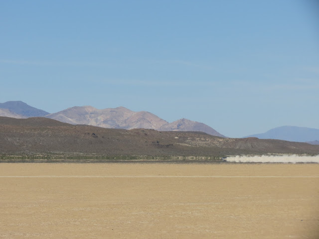
Vehicles driving across the playa make big plumes of dust. There are some designated or well travelled straight lines across the lakebed. Where there is a lot of traffic, there can be an inch or two of soft dust, which really kicks up with vehicles. Most of the lakebed has fewer tracks, and the harder crust doesn't make as much dust.
It was breezy occassionaly, and I was able fly a kite and sort of pull myself along. This was in the middle of the day, when the heat off the lake starts to shimmer. Objects will seem to disappear or float, see my reflection below. I had made some sort of joke like 'come find me if I don't come back', and then I also forget my water bottle. So when I disappeared after a half hour, Annie & Elliot drove out looking for me. And Elliot got some more driving time too.
After two nights, we went down through Gerlach to the south, and then the gravel roads to the east, through Sulfur, NV. Not much there, big sulfur mine though. If we go this way again, I'd go straight across the Black Rock playa, avoiding most of the pretty poor gravel road, route 48, from Gerlach towards Sulfur.
To the east of Sulfur is another smaller lake bed, 2-3 miles across. We stopped for lunch, and continued on. It was weird driving on this one, maybe seeing the edges not so far away, it felt like we were on ice and it might fall through.


What an adventure! A totally different Landscape. And I could feel the heat of the day through your pictures.
ReplyDelete